
Meteorologists are closely tracking the potential for a significant Sandhills winter weather event this weekend, as a powerful storm system takes shape across the Southern United States.
According to the WRAL WeatherCenter, forecast models are increasingly aligned in showing a winter storm that could impact central and eastern North Carolina on Saturday and Sunday, including Moore County and the surrounding Sandhills region.
Why This Weekend’s Storm Has Meteorologists Watching Closely
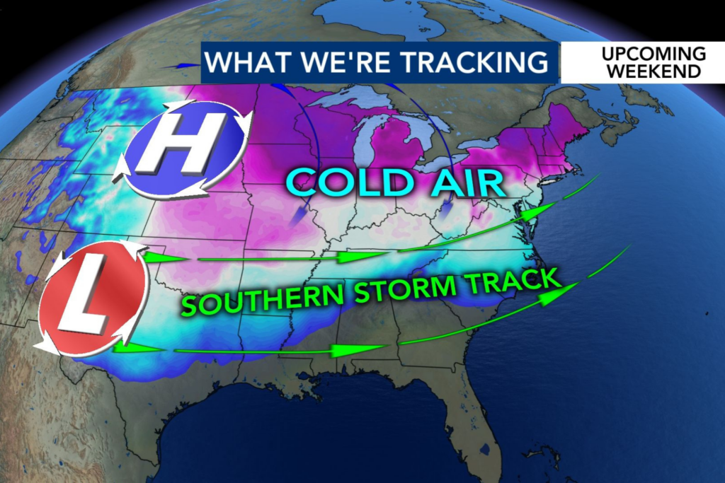
Weather experts say the setup is more favorable than last weekend’s system, which only produced spotty snow. This time, an Arctic high-pressure system is expected to funnel cold air south while a low-pressure system pulls in moisture from the Gulf.
That combination — cold air meeting deep moisture — creates the potential for snow, sleet, or freezing rain across parts of the Sandhills.
What Could Change the Forecast
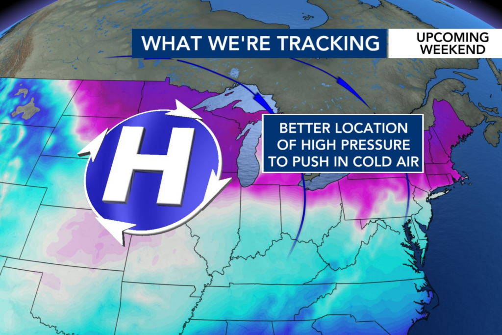
The exact track of the storm will determine precipitation types. If the cold air holds firmly in place, winter weather impacts could be more widespread. If the system shifts, totals and impacts could change significantly.
Forecasters note that while smartphone weather apps may already show snowfall totals, those projections should be taken cautiously several days out, especially for winter weather in the South.
When Will We Know More?
More accurate details on timing, precipitation type, and potential impacts for Southern Pines, Pinehurst, Aberdeen, and Seven Lakes are expected within one to three days of the storm.
In the meantime, residents are encouraged to review winter weather plans and stay tuned for updates as forecast confidence increases.
Star 102.5 will continue tracking Sandhills winter weather conditions and share updates as new information becomes available.