
With the possibility of winter weather, now’s the time to get ahead of any storm outages. Power outages can be unexpected and disruptive, but Carolina Air and Power is here—keeping homes warm and powered all season long. Call 910‑240‑4627 or visit CarolinaAir.com to stay prepared.
As we head into the weekend in the Sandhills region of North Carolina, residents and visitors can expect a mix of mild temperatures, rain showers, and even a chance of snow as the weather pattern shifts through Saturday and Sunday.
Saturday will deliver a welcome break from the cold with partly sunny skies and highs near the mid-50s, making it a great day for outdoor activities across Southern Pines, Pinehurst, Aberdeen, or nearby Fayetteville. However, clouds will build late in the day, setting the stage for changing conditions overnight.
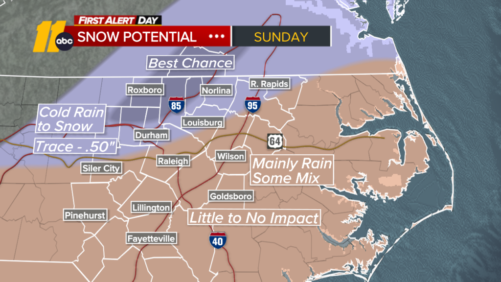
Saturday night brings a likely rain event that may mix with snow late, especially as temperatures drop into the low 30s. While any snow accumulation is not expected to be significant, slick spots could develop on untreated surfaces in the early morning hours.
Sunday will be cooler with highs around 40–41°F and scattered showers. For those planning travel or outdoor plans, keep in mind there’s a chance of rain turning to a rain/snow mix at times, especially through the afternoon.
By Sunday night into Monday, skies will begin clearing with brisk, sunny conditions returning and daytime highs rebounding near the upper 40s. It will feel crisp and winter-like, so be sure to dress warmly for early morning errands or outdoor walks.
Weather-Smart Tips for the Sandhills This Weekend
- Stay updated — temperatures could drop quickly after sunset.
- Plan travel early on Sunday if you’re heading out — showers expected.
- Keep winter gear handy — even a light snow mix can make roads slick.
For the latest watches, warnings, and radar updates, check the National Weather Service or your preferred local weather provider, especially on Sunday, as conditions evolve.
Credit: ABC11